
Hi! My name is Julian. I'm a masters student at the University of Missouri studying computer science. My research interests are graph algortihms, constrained shortest paths, geogrpahic information systems, vehicle kinematics, and spatial networks analysis.
Research
Academic contributions, GIS analysis, algorithm design, and publications.
Constrained Pathfinding Algorithms
In ProgressThis research focuses on the development, implementation, and optimization of two related methods for computing shortest paths subject to turn constraints. The work involves improving an existing modification to Dijkstra's algorithm to efficiently handle turn angle and length requirements when finding paths.
The project aims to demonstrate comparable performance to previous methods despite solving a more complex problem.
Turn-Angle Constrained Isochrones
Spring 2026The project utilized a Turn-Angle Restricted shortest paths algorithm to create restricted isochrones in London, UK. The project demonstrated the potential impacts of considering vehicle restrictions in reachability analysis.
Future work will focus on refining the approach and exploring applications outside of road networks, and in complex environments.
Projects
Personal coding projects and geospatial analysis.
Austin Crash Dashboard
Spring 2024
Gathered crash data from Austin, Texas and created an atlas of maps broken down by police districts. Developed a dashboard for each district including metrics on average crashes, fatalities, and injuries.
Languages and Technology: Python, ArcGIS, ArcPy, Numpy
Home Ownership Analysis
Fall 2023
Explored the relationship between home ownership rates and proximity to public transportation in Hennepin and Dakota County, Minnesota. You can view the full project poster here.

Software: ArcGIS
Flood Extent Mapping
Fall 2024
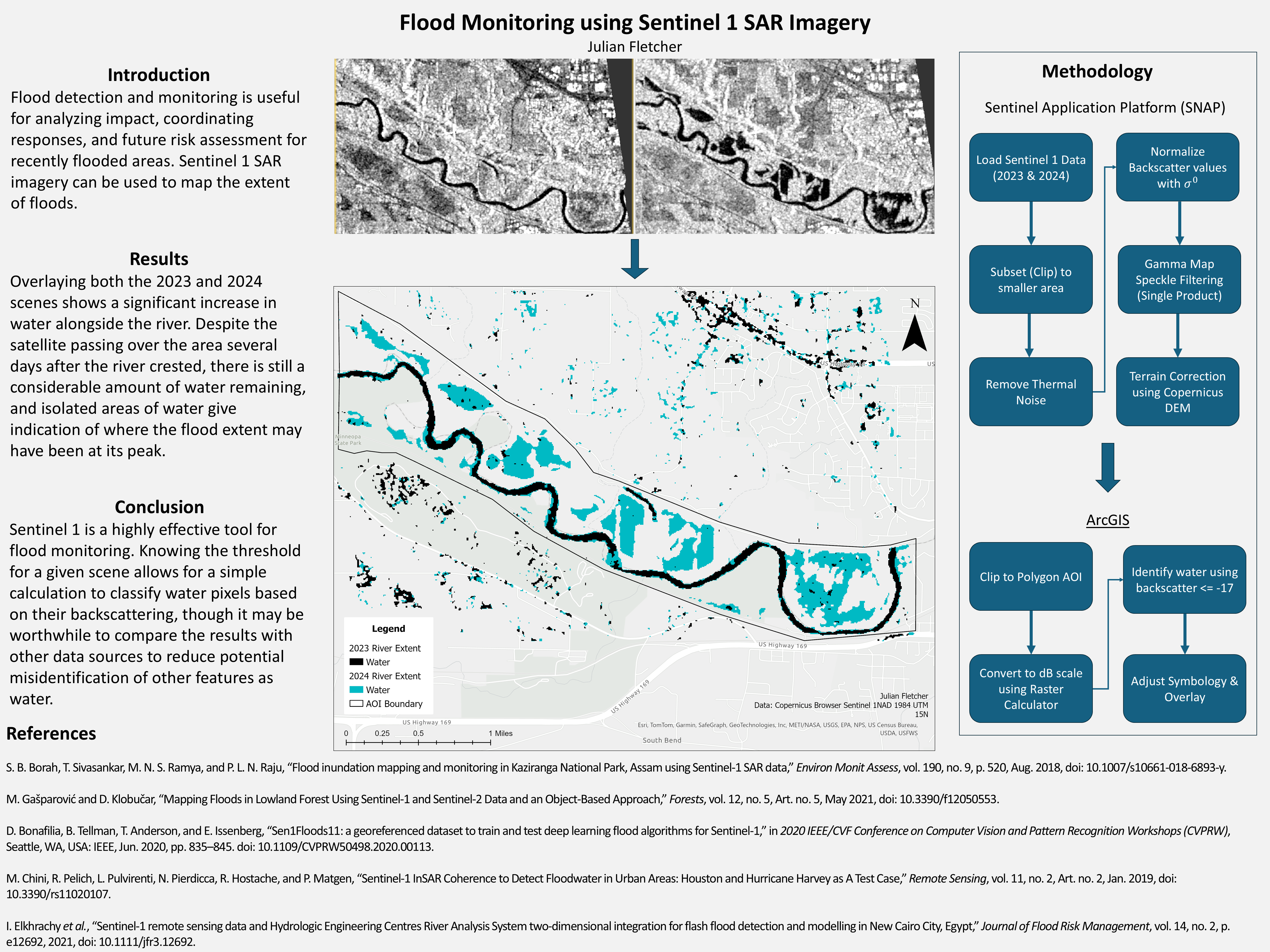
Utilized Sentinel-1 SAR data to detect and map flooding near Mankato, Minnesota along the Minnesota River. You can view the full project poster here.
Software: ArcGIS, SNAP
Coming Soon!
A cool project that is currently in development. Stay tuned for updates!
Skills
Programming Languages
C / C++
Python
Java
SQL
JavaScript / TypeScript
HTML / CSS
LaTeX
Geospatial Technologies
ArcGIS Pro / ArcPy
Sentinel 1 SAR
SNAP
Change Detection
Spatial Indexing
Systems & Architecture
Git
CMake
Agile (SDLC)
Server Management (Proxmox)
Distributed Computing
MPI / OpenMP
GPU Acceleration / OpenACC
Algorithmic Expertise
Kinodynamic Planning
Computational Geometry
Graph Theory
Complexity Analysis
Web Development & Testing
React
AngularJS
NodeJS
RESTful APIs
Vitest / Cypress